Site Gallery - Diagram
- All tags
- #Design Studies
- #Render
- #Interior Views
- #Section
- #Elevation
- #Exterior Views
- #Drawings
- #Floor Plan
- #Views
- #Education
- #Urban Design
- #Axonometric
- #Technical Drawing
- #Diagram
- #Laurieston
- #Perspective
- #Model
- #Site Plan
- #Art Gallery
- #3D
- #collage
- #Exploded Axonometric
- #sketch
- #Masterplan
- #Concept
- #Diagrams
- #Site
- #Front Elevation
- #Housing
- #Renderings
- #Community Centre
- #Technical Design
- #Plans
- #conservation design project
- #Context
- #hand drawing
- #isometric
- #Public spaces
- #Technical Studies
- #landscaping
- #Structure
- #Cultural Studies
- #History
- #Dementia
- #Neighbourhood
- #Professional Studies
- #Art Gallery in the City
- #Environment
- #photomontage
- #Sustainable production
- #Construction
- #detailing
- #M8
- #Market
- #Physical Model
- #Programme
- #street elevation
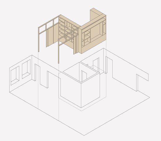
Transforming spaces through timber inserts - Zachariasz Czerwinski
Design Studio 3A
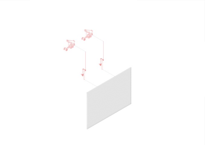
Exploded Axonometric Detail 1:50 - Conor Ryan McCormack
Down The Rabbit Hole_3B To Play
Down the Rabbit Hole_3B To Play.
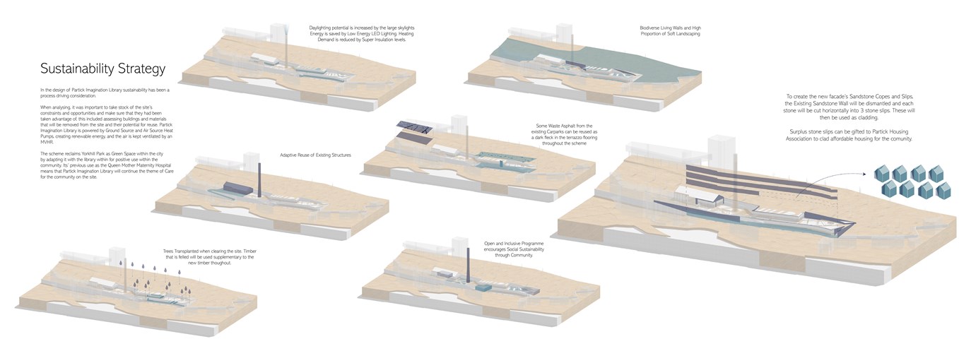
Andrew McCluskie
Sutainability Diagrams
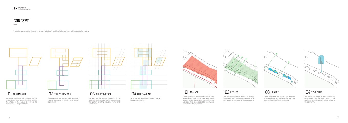
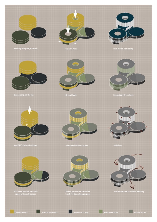
Conceptual Diagrams - Shivani Sarjan
Laurieston Education Hub
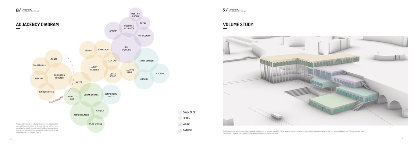
Adjacencies and Volume Study - Shivani Sarjan
Laurieston Education Hub
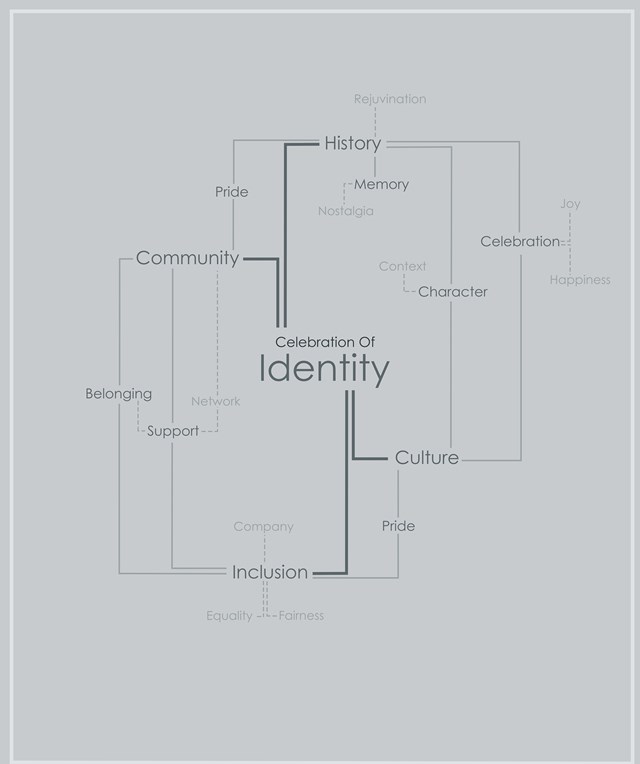
Mind-map Showing the Effects of Celebrating an Areas Identity - Kate Melhuish
There is a habit removing or hiding it history and not preserving buildings for use and signifying their importance leaving derelict site and buildings throughout the Clyde area. By removing these areas of importance from their neighbourhood in turn you lose the areas identity and this contributes to a loss of community and connection to the city along with perpetuation the rise in mental health issues. By celebrating a places identity and history, bringing these areas back to life for their communities we can bring people back together and create spaces for communities, increasing their connection to each other and to the city as a whole.
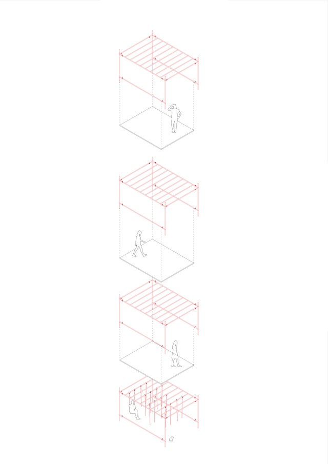
Exploded Axonometric Detail 1:50 - Conor Ryan McCormack
Down The Rabbit Hole_3B To Play
Down the Rabbit Hole_3B To Play.
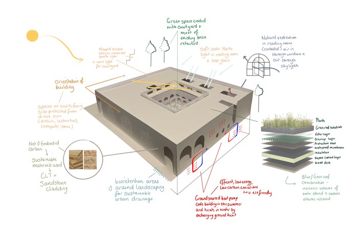
Environmental Strategies - Leena Hussain
Based on RIBA sustainable outcomes.
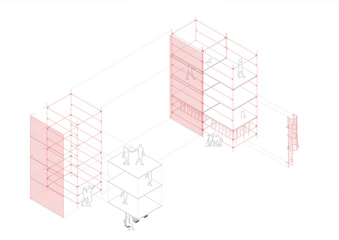
Scaffolding Structure Diagram 1:50 - Conor Ryan McCormack
Down The Rabbit Hole_3B To Play
Down the Rabbit Hole_3B To Play.
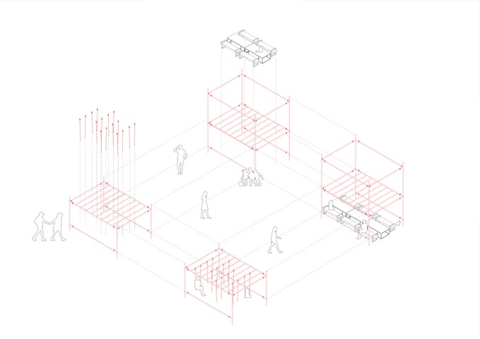
Scaffolding Structure Diagram 1:50 - Conor Ryan McCormack
Down The Rabbit Hole_3B To Play
Down the Rabbit Hole_3B To Play.
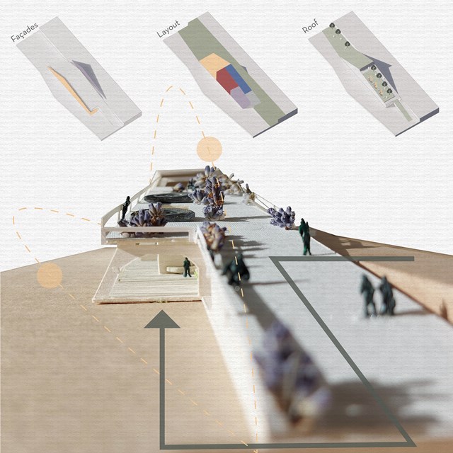
Concept - Viktoria Georgieva
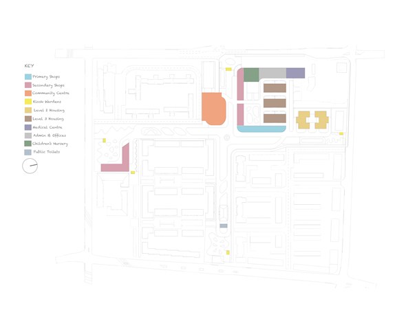
DFN Proposed Buildings - Adele Melas
The DFN masterplan proposal includes the following buildings: Primary Shops, Secondary Shops, Community Centre, Kiosk Wardens, Moderate Dementia Housing (Level 2), Severe Dementia Housing (Level 3), Medical and Health Centre, Admin Offices, Children's Nursery, and Public Toilets.
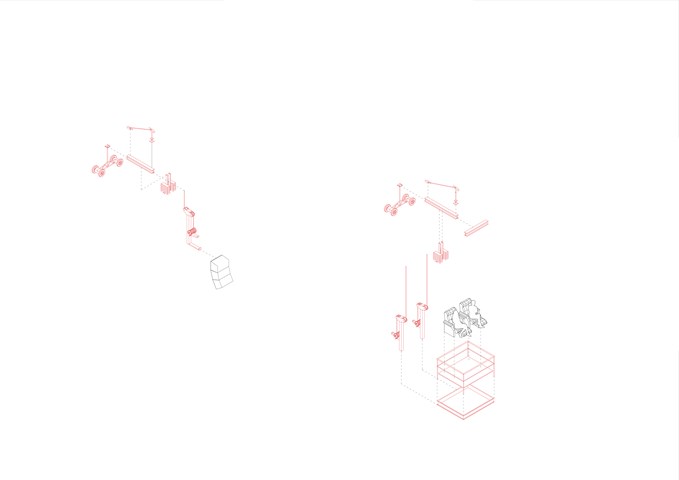
Exploded Axonometric Detail 1:50 - Conor Ryan McCormack
Down The Rabbit Hole_3B To Play
Down the Rabbit Hole_3B To Play.
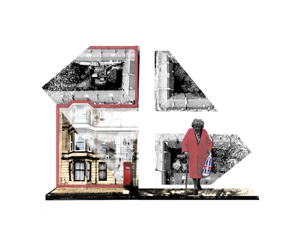
The Cross Concept - Adele Melas
Crosses are conceptually chosen as the ideal settings to accommodate the Dementia Friendly Neighbourhood. Being vibrant in character and centralised in location, they offers individuals with dementia the opportunity to continue life as normal, participate actively and integrate with society. Often stemming into high streets, they increase accessibility and safety between homes and primary services, which heightens independence and confidence. Vitaly, they facilitate the creation of a ‘walkable zone of experience’ for individuals with dementia (Blackman, 2006).
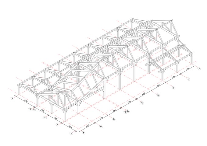
Structural Diagram - Glulam Frame - Victoria Rozewska
Technology Studies
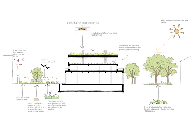
Biodiversity Section - Rachel McLure
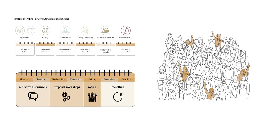
Programme for the Rhodope Council - Elena Stefanova
The Council decides on policies and laws in six sectors related to the local land and resources: agriculture, forestry, water resources, fishing and hunting, extractable resources, and renewable energy. Between the end of October and the beginning of December, a week of events is dedicated to each of the six sectors. Eligible members of the community have the opportunity to discuss previous progress, suggest, workshop, and vote on their proposals for the development of the region
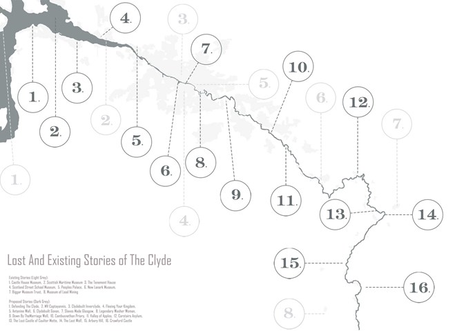
Map of the Clyde Highlighting Existing Celebrations of History and Opportunities for New Ones - Kate Melhuish
The Clyde is the main river that flows in the west of Scotland. It is a major feature in the natural landscape. Not only is it a prominent feature in the natural landscape but it is also key element in the development of places, memories and stories. This map highlights some of the told and untold stories that run along the riverside. Within this project I explored various stories and created an architectural time capsule of one, which can be used as an example of how to produce this corridor of memories, celebrating lost stories.
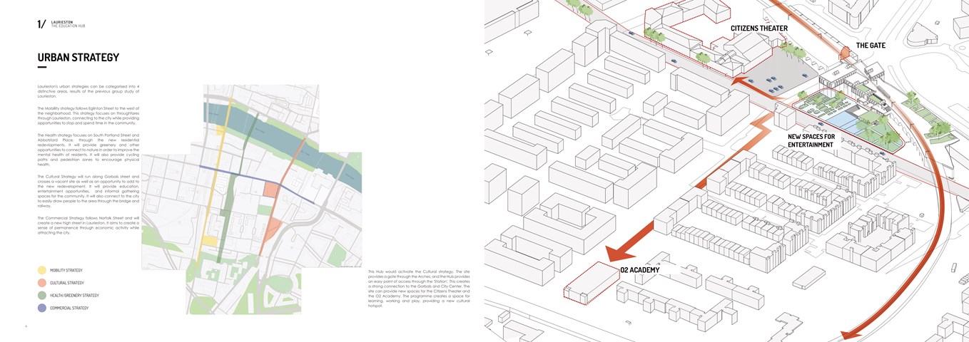
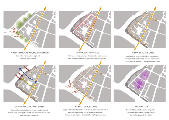
Urban Strategy - Shivani Sarjan
Laurieston Education Hub
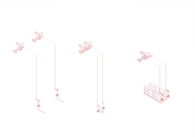
Exploded Axonometric Detail 1:50 - Conor Ryan McCormack
Down The Rabbit Hole_3B To Play
Down the Rabbit Hole_3B To Play.
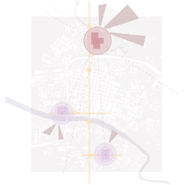
City Brief Diagram - Rebecca Irving
Sites were identified based on issues such as vacant and derelict land, feelings of safety, and areas of deprivation.
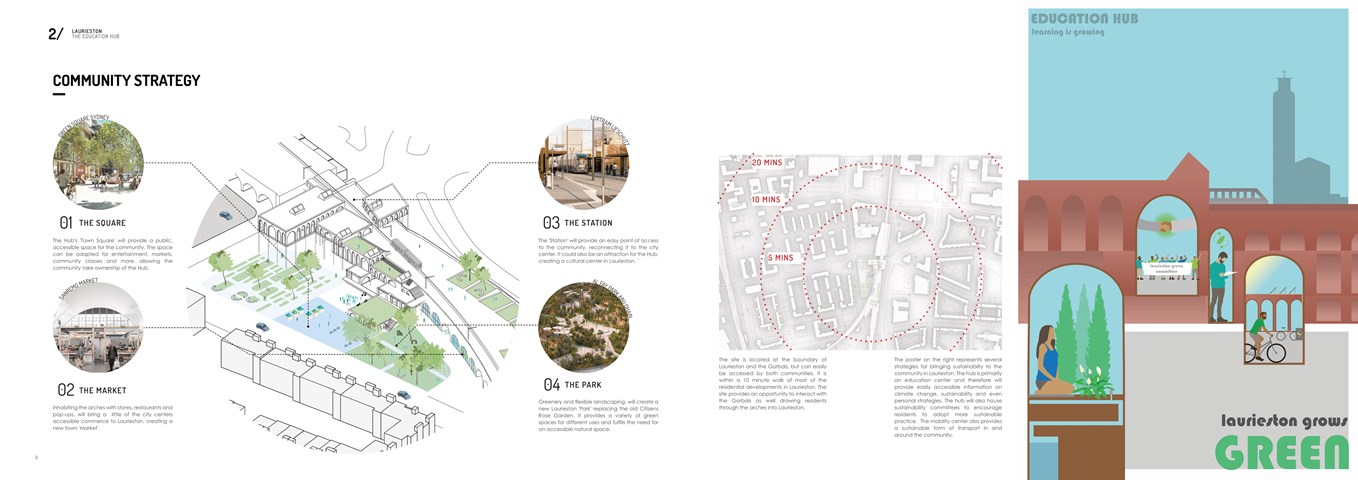
Community Strategy - Shivani Sarjan
Laurieston Education Hub
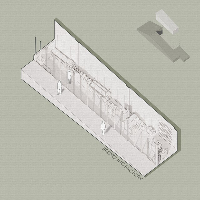
Recycling Factory - Viktoria Georgieva
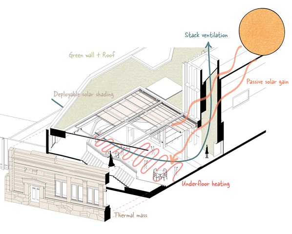
Environmental diagram - Alfie Hollington
Design Studies 3b
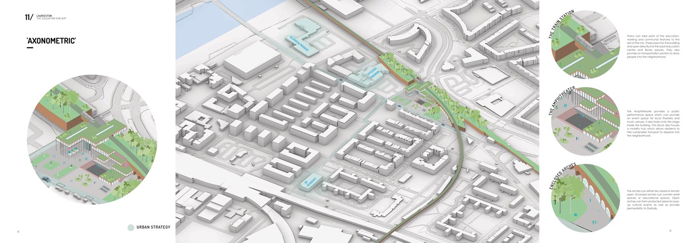
Axonometric Diagram - Shivani Sarjan
Laurieston Education Hub
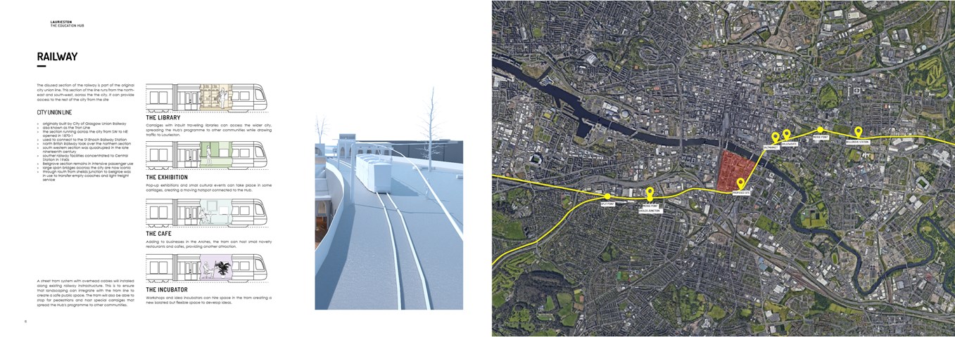
The Railway Line - Shivani Sarjan
Laurieston Education Hub
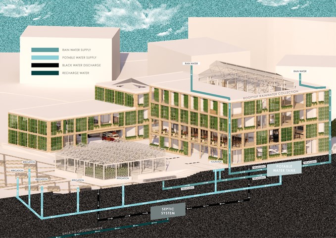
ENERGY STRATEGIES: Rainwater Harvesting System - Gertie Leong Hei Li
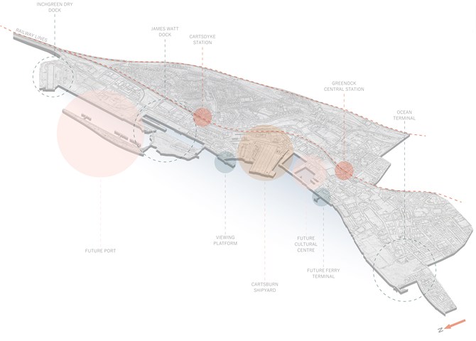
Future Riverfront Masterplan Diagram - Ellie Carroll
