Site Gallery - Site
- All tags
- #Design Studies
- #Render
- #Interior Views
- #Section
- #Elevation
- #Exterior Views
- #Drawings
- #Floor Plan
- #Views
- #Education
- #Urban Design
- #Axonometric
- #Technical Drawing
- #Diagram
- #Laurieston
- #Perspective
- #Model
- #Site Plan
- #Art Gallery
- #3D
- #collage
- #Exploded Axonometric
- #sketch
- #Masterplan
- #Concept
- #Diagrams
- #Site
- #Front Elevation
- #Housing
- #Renderings
- #Community Centre
- #Technical Design
- #Plans
- #conservation design project
- #Context
- #hand drawing
- #isometric
- #Public spaces
- #Technical Studies
- #landscaping
- #Structure
- #Cultural Studies
- #History
- #Dementia
- #Neighbourhood
- #Professional Studies
- #Art Gallery in the City
- #Environment
- #photomontage
- #Sustainable production
- #Construction
- #detailing
- #M8
- #Market
- #Physical Model
- #Programme
- #street elevation
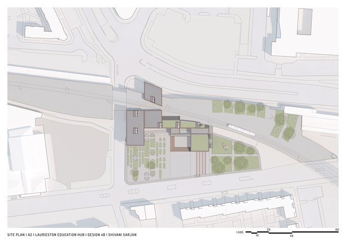
Site Plan - Shivani Sarjan
Laurieston Education Hub
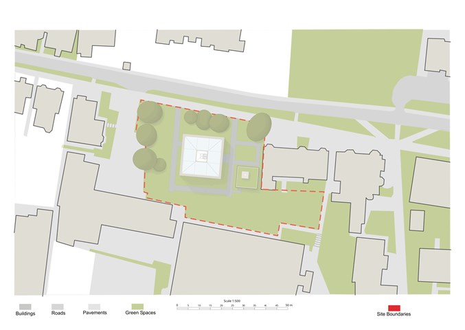
The Site - Freyja Lehnen
The project mainly occupies the upper half of the site as the site was already naturally split into two separate parts. The lower rectangle I left as it was in order to not disturb the view out off the neighbouring residential buildings.
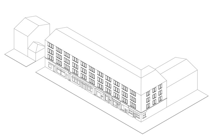
Axonometric of Glasgow Tenements - Laura Kennedy
1:200 Axonometric of the existing tenement block on Great Western Road. Used as part of AB108 site analysis to help understand the rules of the street.
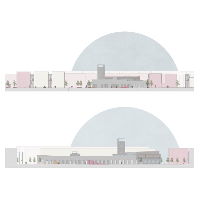
Elevations in context - Asya Gumus
The top elevation shows the 'safe wings' in context and the elevation below shows transparency/ access between street and larger intervention.

Labelled Site Plan of the Shipyard - Ellie Carroll
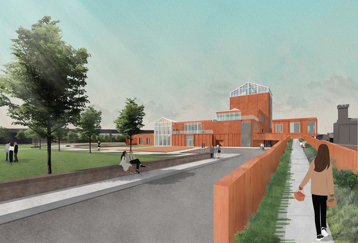
The Ramp Entrance - public access directly to the market, restaurant, garden spaces, and new public park - Fiona Wylie
The site rests on a plinth that is 3.5m above the main street level, and has an existing ramped entrance. To continue the pedestrian walkway in Tradeston's proposed new masterplan, people can directly access the market and gardens without having to go through the whole building. To promote more exterior access, as the site ramps up, so does the building, with a nature path. The nature path wraps around the building, providing direct access from that side of the building to the restaurant, the market seating, the growing areas, and the main greenhouse, all while continuing a green journey to experience the building and create views over the historical wall to the rest of Glasgow.
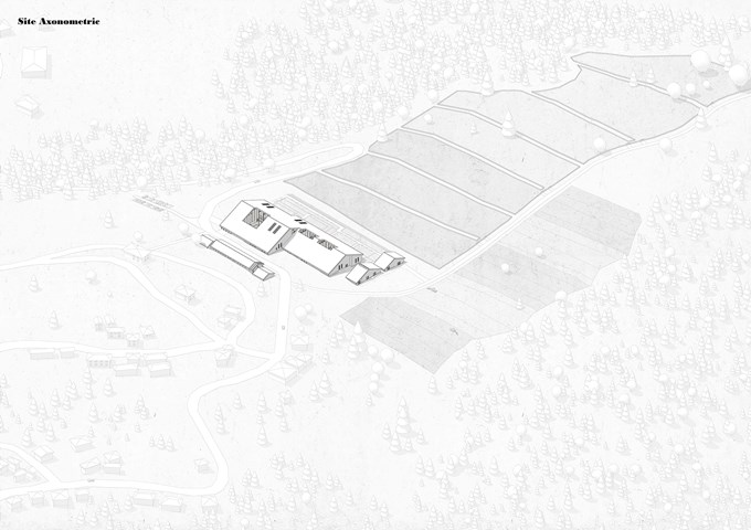
Site axonometric - Elena Stefanova
For the purposes of research and training, the Agrarian Institute has a flock of 45 sheep, pastures, and a model farm set up on site.
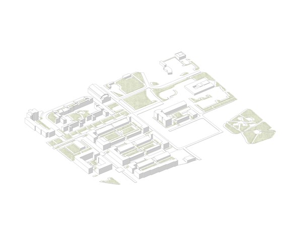
Laurieston Existing Site - Adele Melas
Today the site exists as a Transformational Regenerational Area (TRA), marked as ‘Laurieston Living’. Currently, the housing development is towards the end of Phase 2. Adjoining with the initial concept, the wider site of Laurieston Living is enveloped by various crosses, including Gorbals Cross and St. Andrews Cross, which help increase opportunity for dementia-friendly outdoor environments. The Dementia-Friendly Neighbourhood (DFN) proposal aspires to integrate with future plans in Phase 3. Ultimately, this fusion would reinforce a Neighbourhood For Life (NFL) concept; a key component to creating inclusive environments (Mitchell et al., 2010).
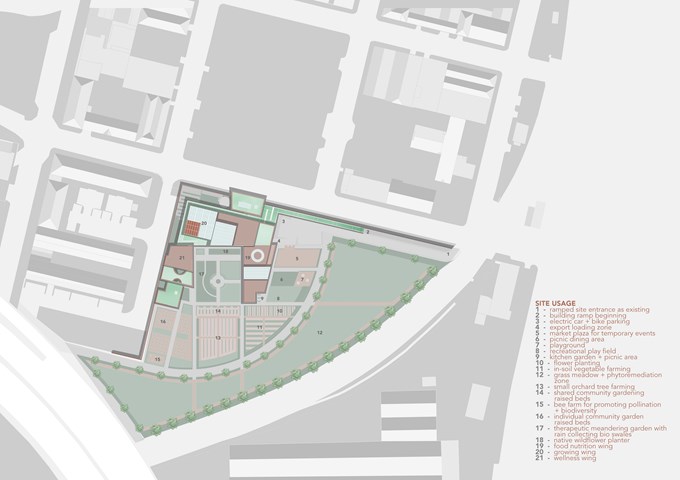
Site Usage Plan - Fiona Wylie
Due to the site's unique placement and size, it is ideal for not only indoor vertical farming, but also allows for exterior agriculture, community gardens, and public spaces to bring more open green space to Tradeston.
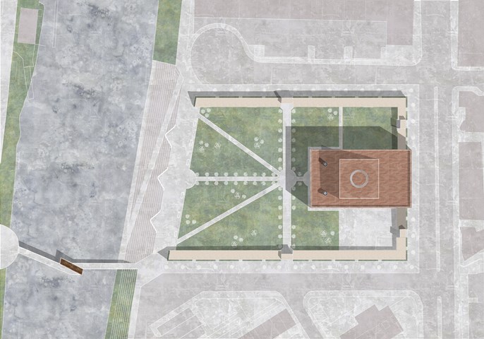
Site Plan of Part E of the Masterplan - Kate Melhuish
The Building aims to provide an immersive experience celebrating the Story of the Glasgow Washer Woman. This story if split into three parts.
Part 1 is the Glasgow washer woman: The collective act of washing and getting clean has been prevalent throughout Glasgow's history. Before the creation of the bathhouse, or Steamie, the women from a certain area would gather together and head down to the river to perform the ritual of cleaning. The washing of cloths became a social and community activity, a time for women to communicate and support one another.
Part 2 is the Goddess Clota: Depicted as a lone washer woman seated on the edge of the river or a ford the Goddess Clota was the Celtic deity of the Clyde. They worshiped the water and regarded the river as sources of fertility. The Clyde was known as the purifying as it carried large amounts of mud to sea when it flooded. an earlier name for it was Clwyd meaning heard from a distance. These qualities of the river were reflected in the Goddess she was known to be pure and hold the divine ear.
Part 3 Is the Bean Nighe who is depicted as a lone washer woman. She is a female spirit or banshee, a messenger from the other-world. She can be seen washing blood from cloths at the ford of a river, it is believed that these are the cloths of those about to die. If approached with caution, a person may be able to get between her and the river they are entitled to the granting of three wishes or the telling of three truths. This varies within different versions of the legend.
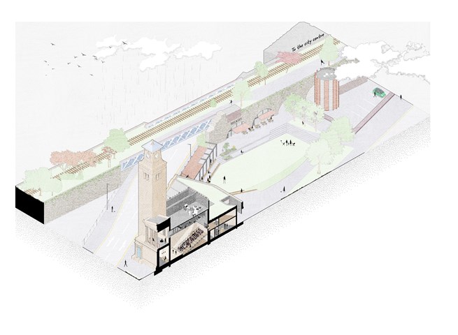
Isometric site section - Alfie Hollington
Design Studies 3b
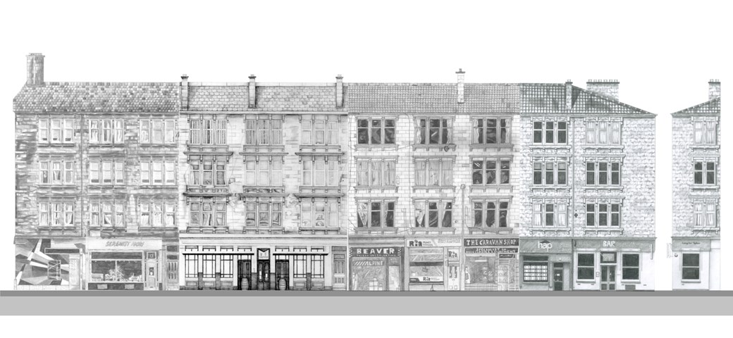
Street Façade - Laura Kennedy
1:50 Pencil study of the whole tenement block. This elevation was created by combining the different façade 'slices' drawn by various students in Unit 8.
Laura Kennedy, Sam Sharkey, Cara Thomson and Zuzia Grajewska
Laura Kennedy
Laura Kennedy, Sam Sharkey, Cara Thomson and Zuzia Grajewska
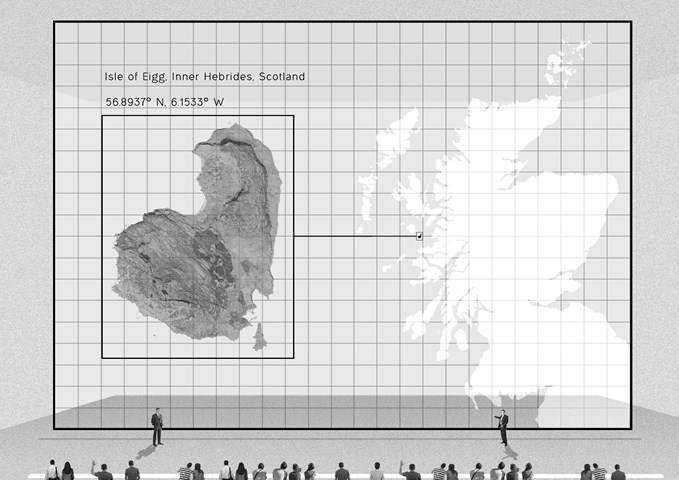
Site location - Daniel Kelly
The Scottish government proposed new Scottish new towns located on the highlands and islands to deal with the overpopulated central belt. One of these site locations is on the Inner Hebridean Isle of Eigg.
