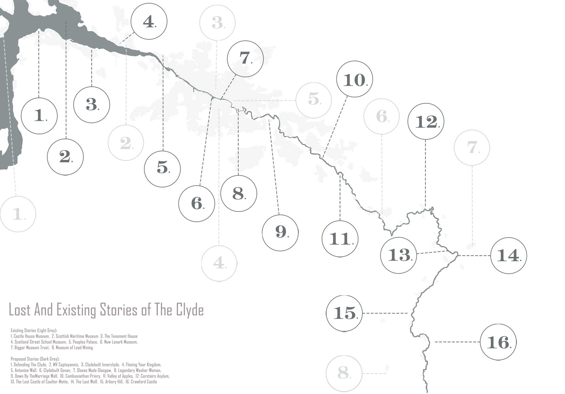
Map of the Clyde Highlighting Existing Celebrations of History and Opportunities for New Ones
Environmental diagram

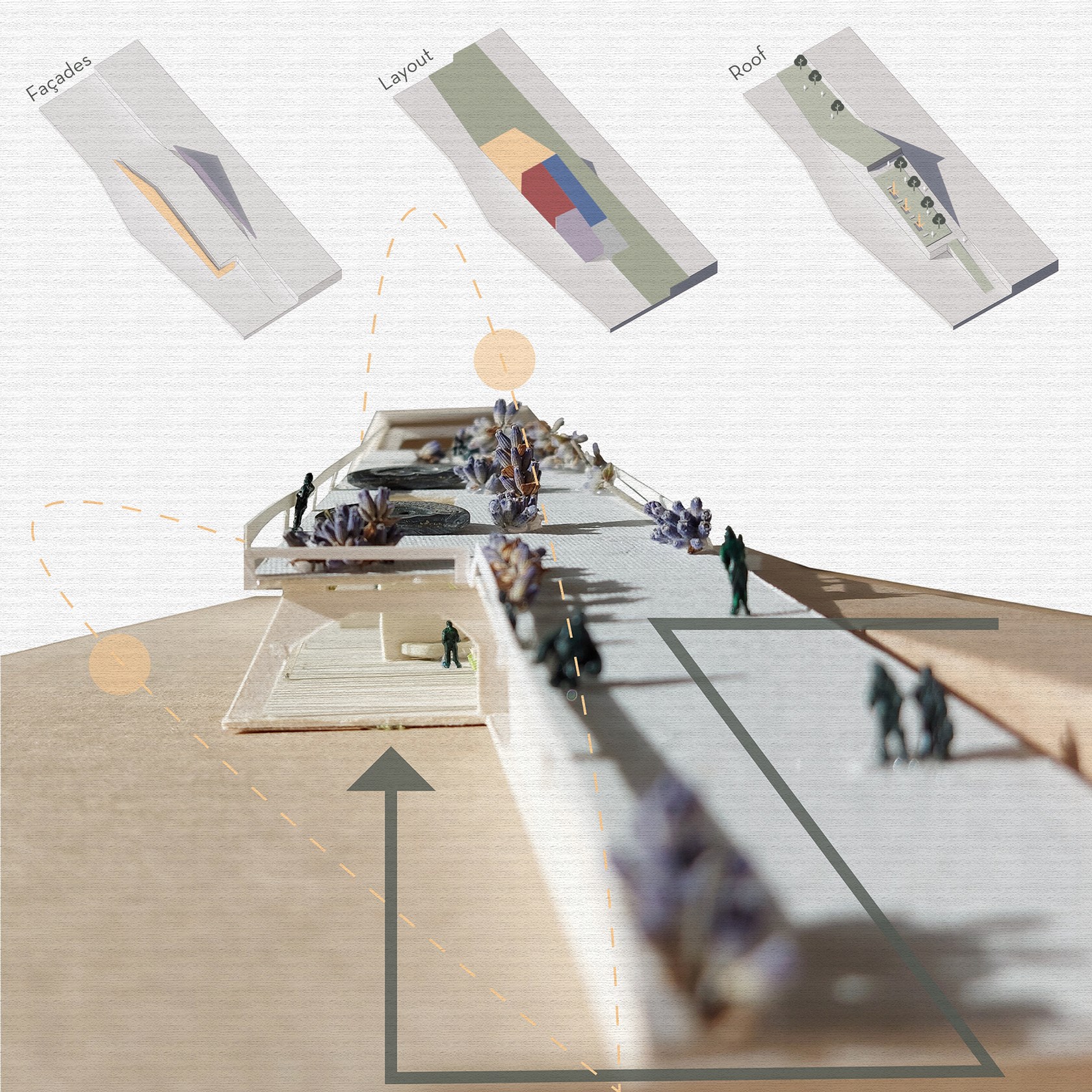
Massing Diagrams
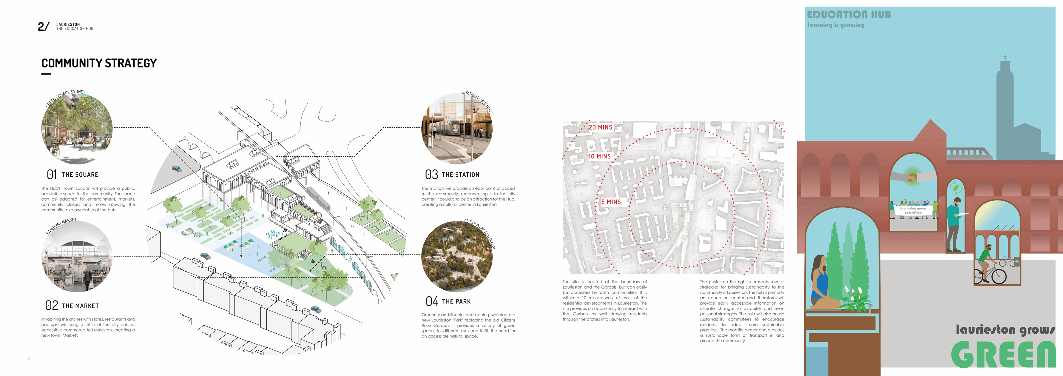
Community Strategy
Mobility Planning Diagram
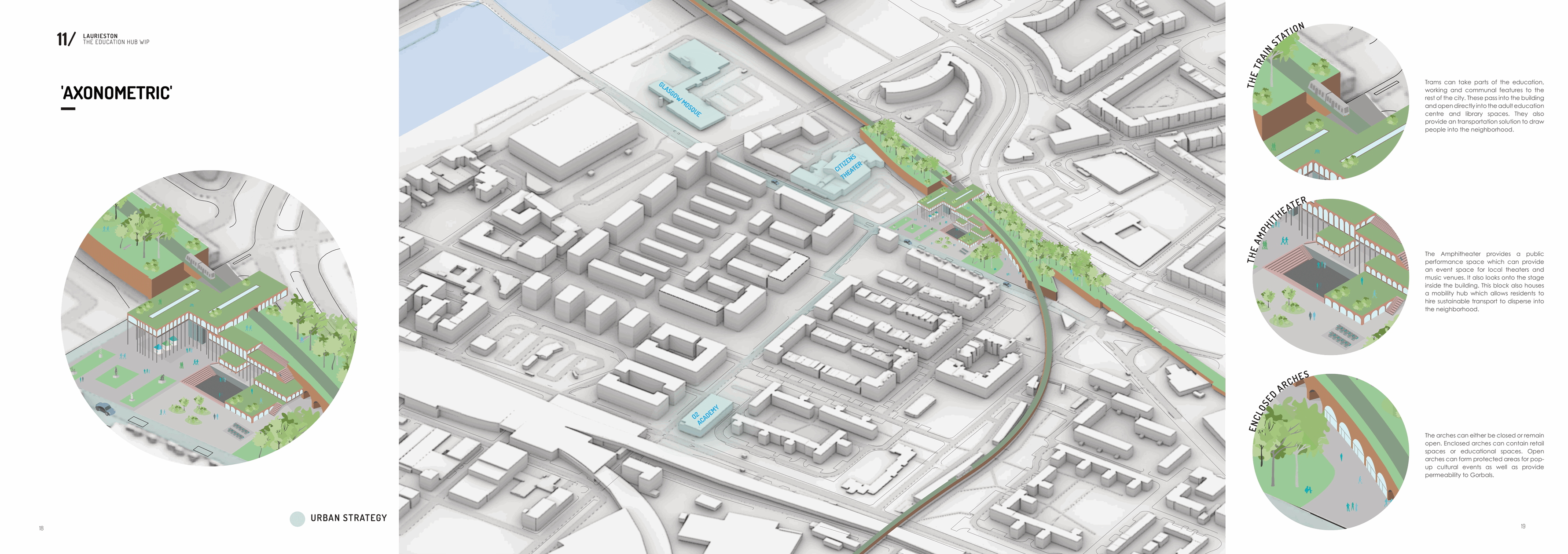
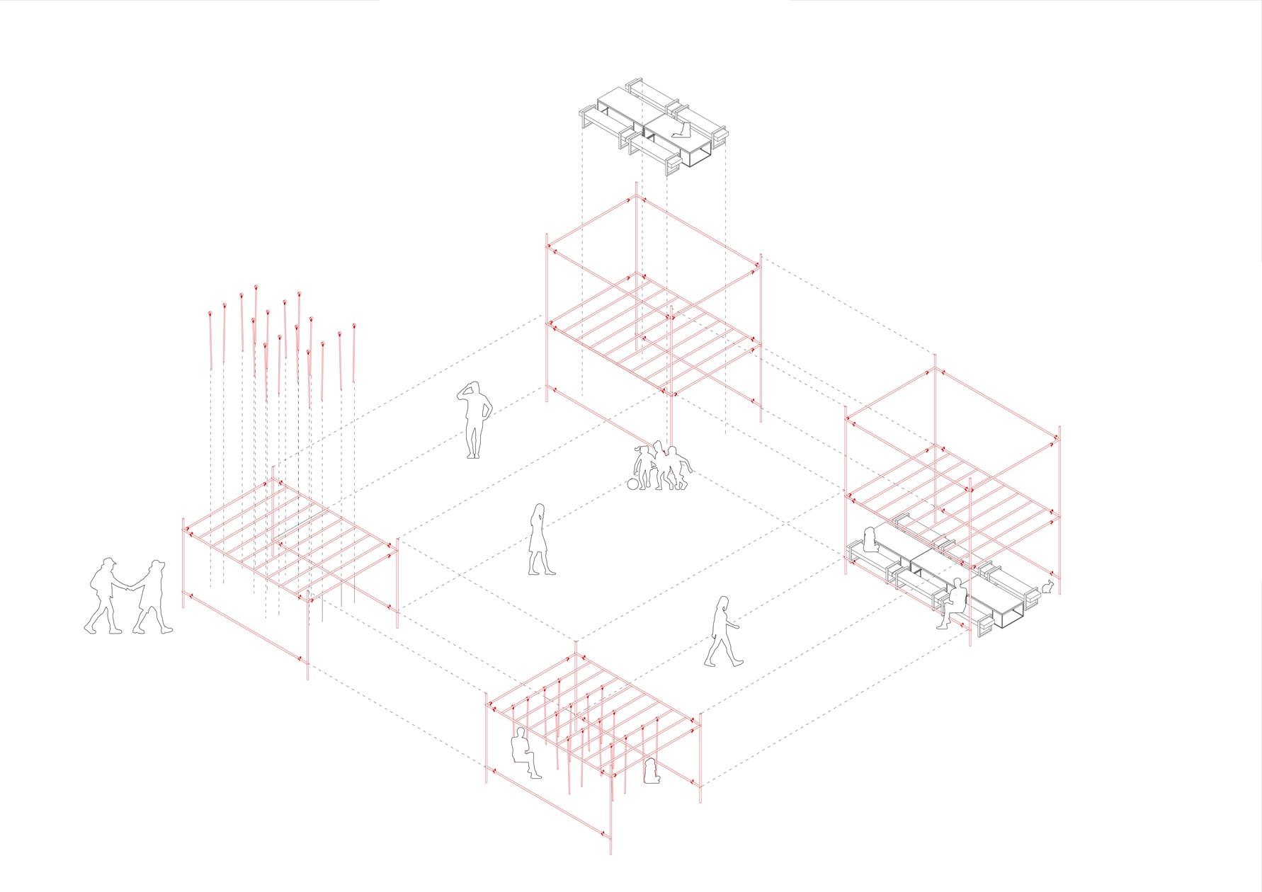
Axonometric Diagram
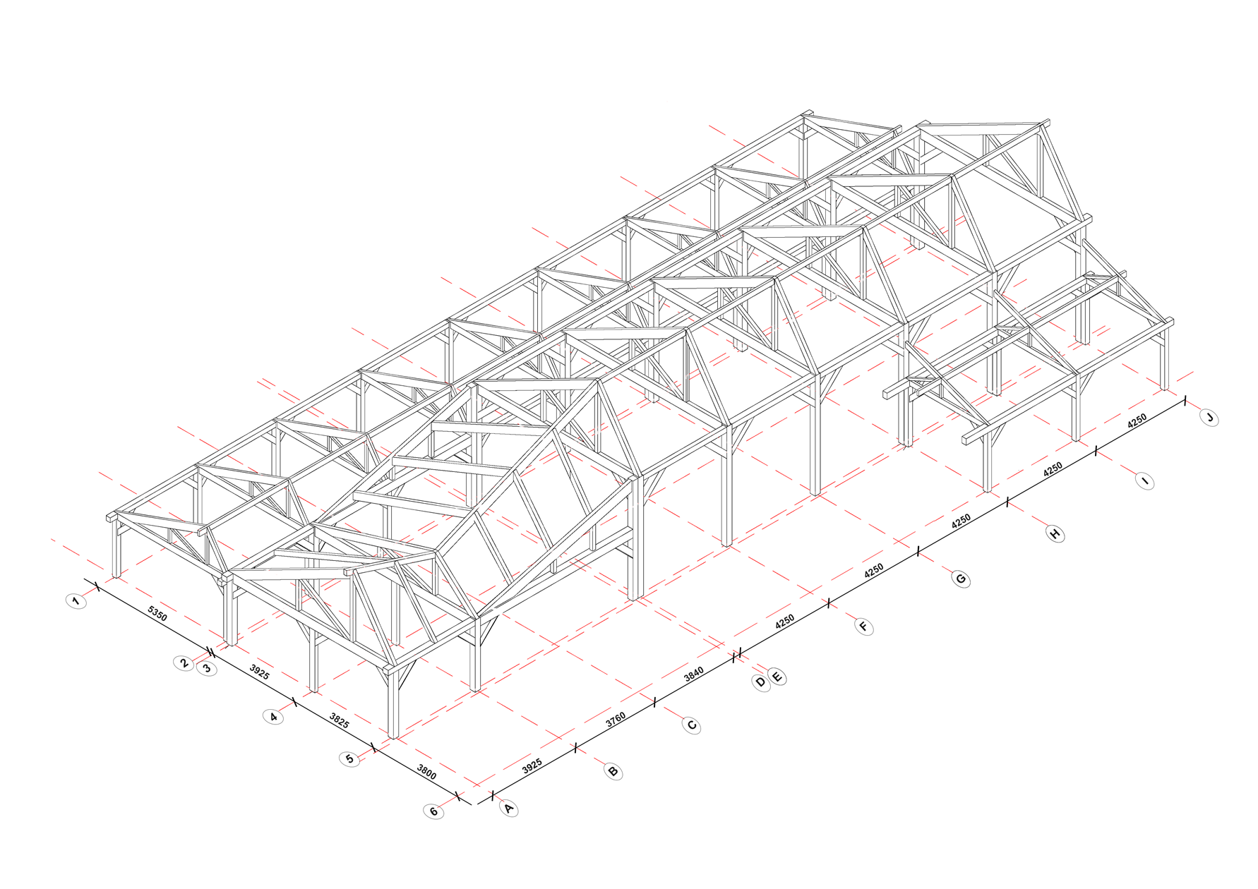
Structural Diagram - Glulam Frame
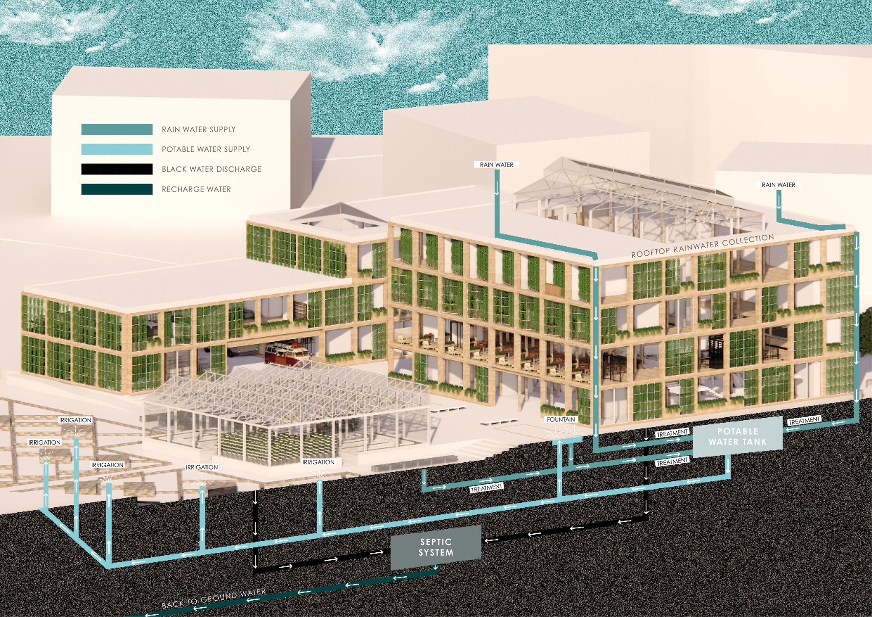
ENERGY STRATEGIES: Rainwater Harvesting System

Mind-map Showing the Effects of Celebrating an Areas Identity
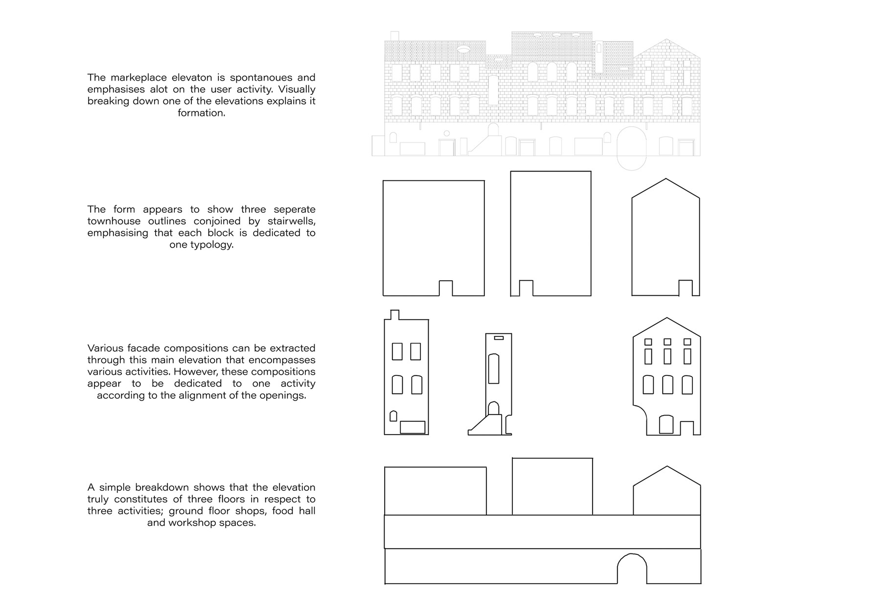
Elevation diagram

Exploded Axonometric Detail 1:50
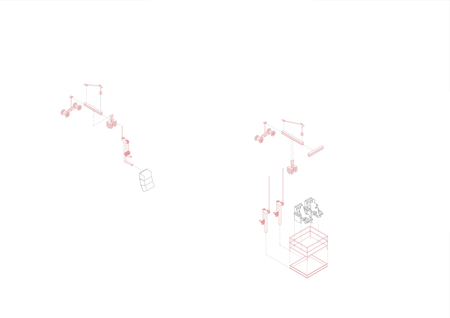
Exploded Axonometric Detail 1:50
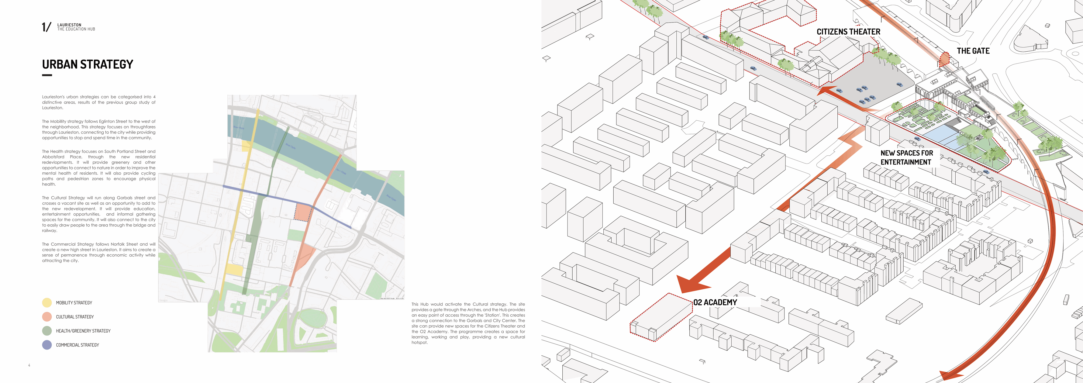
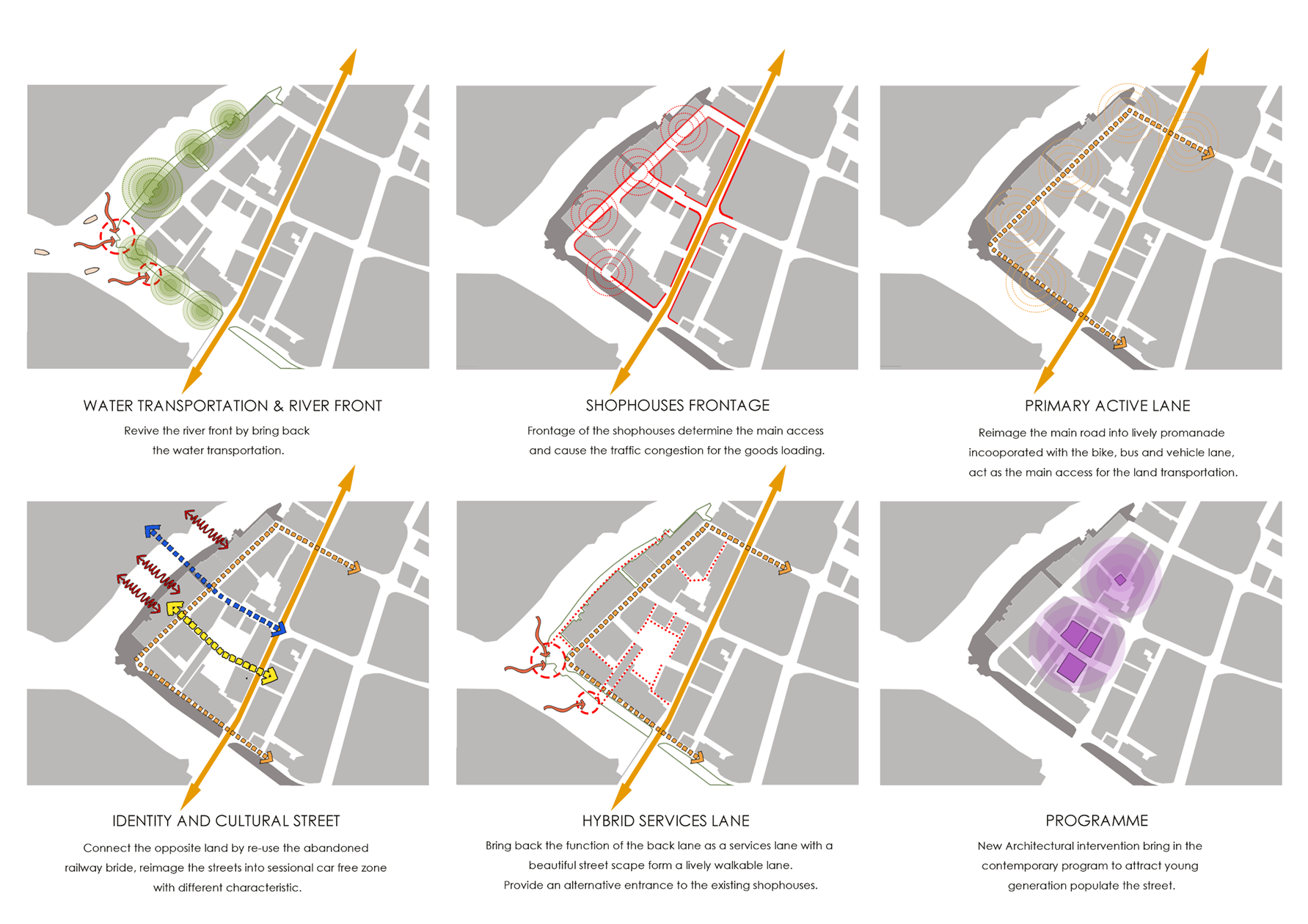
Urban Strategy
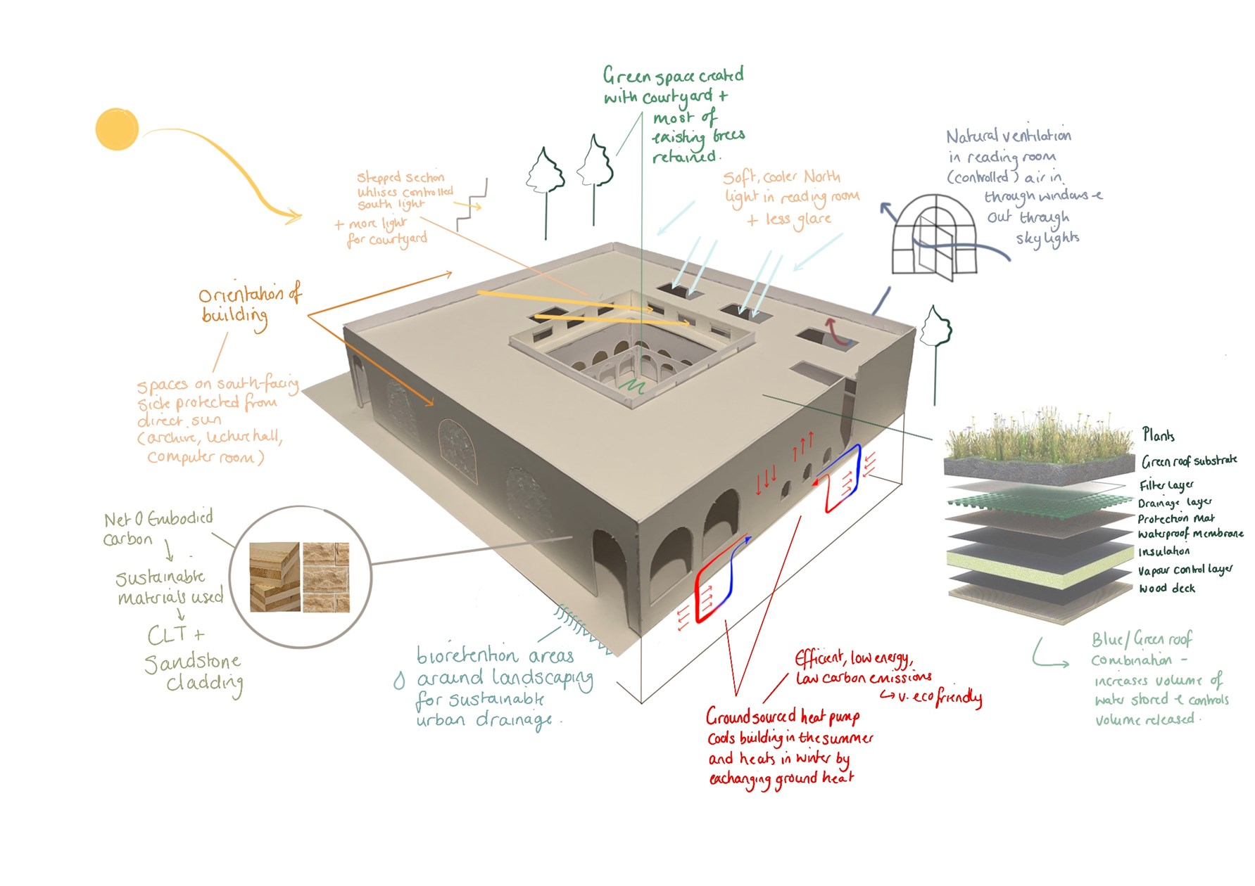
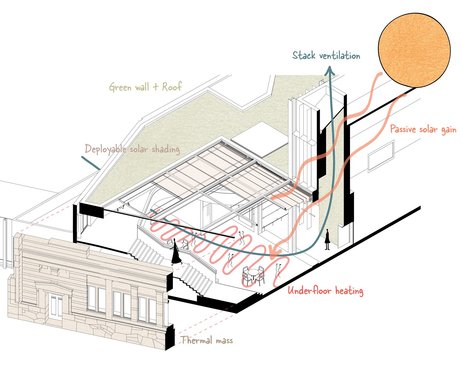
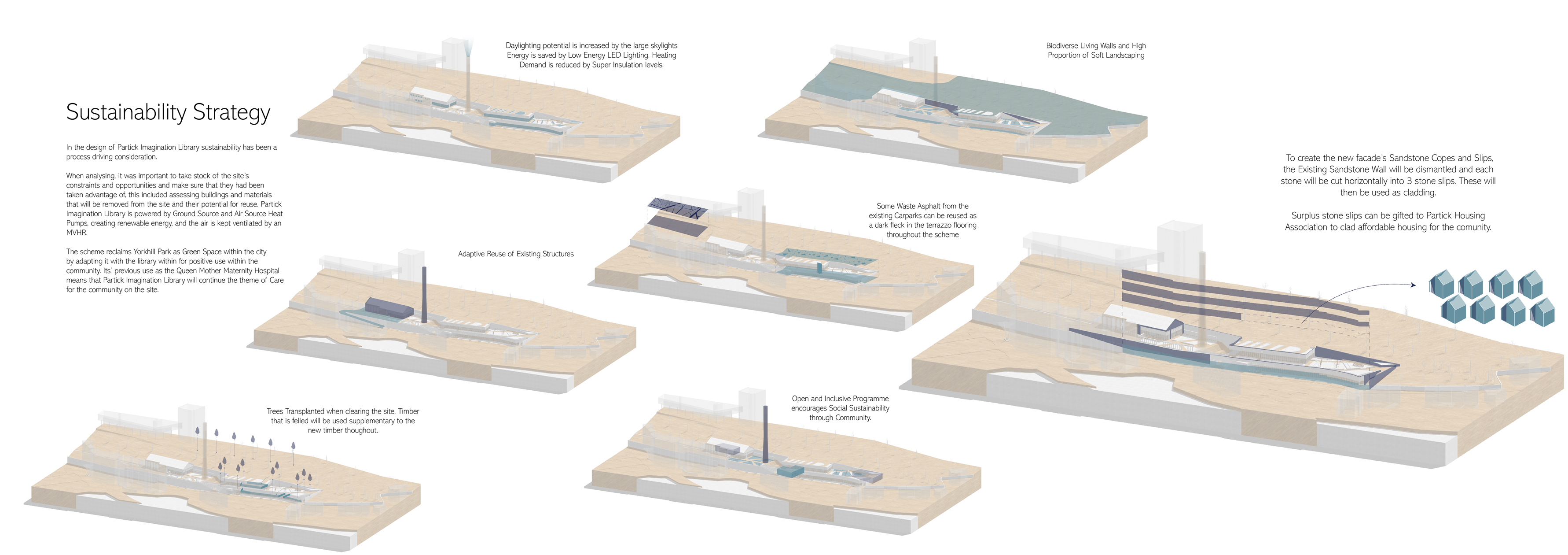
Environmental Strategies
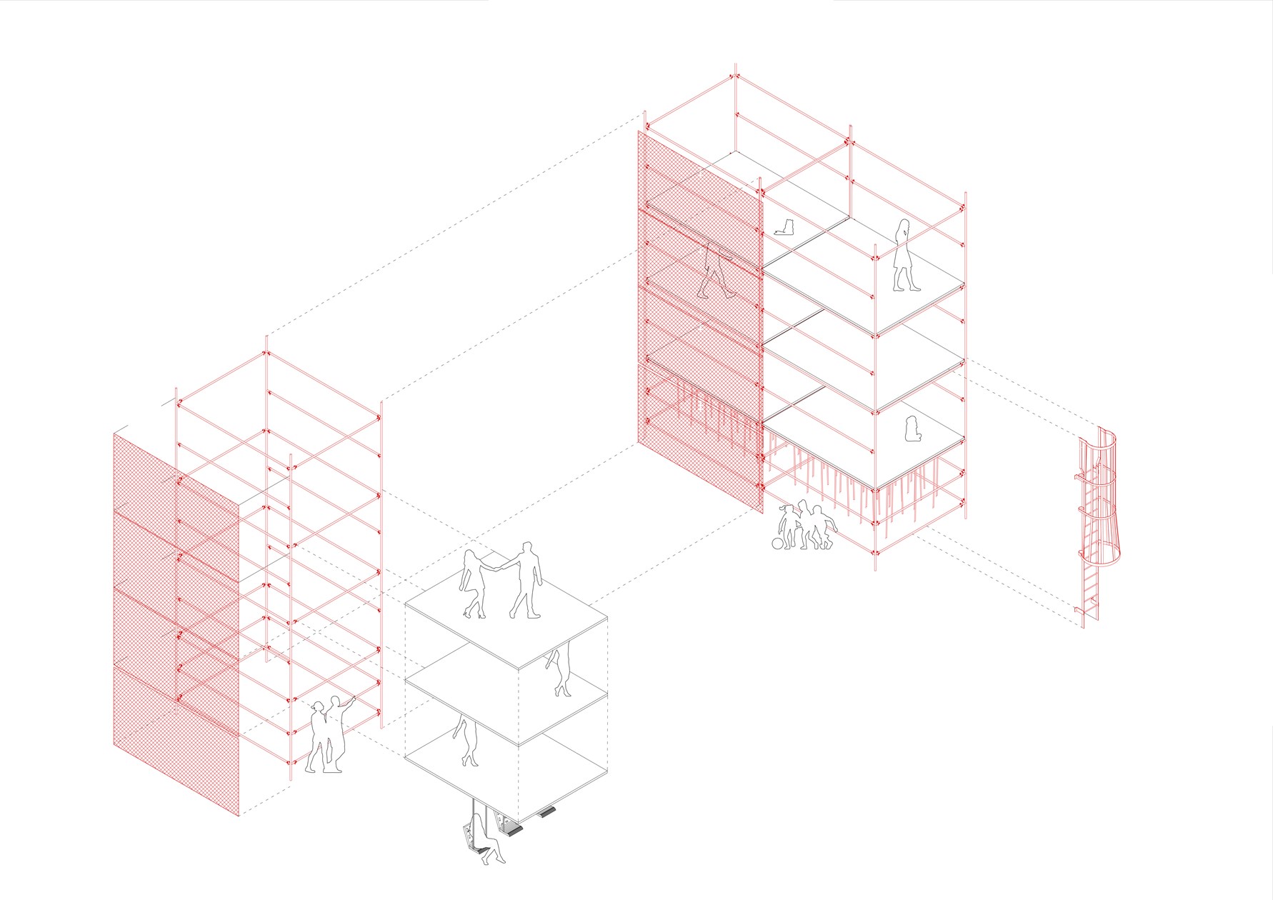
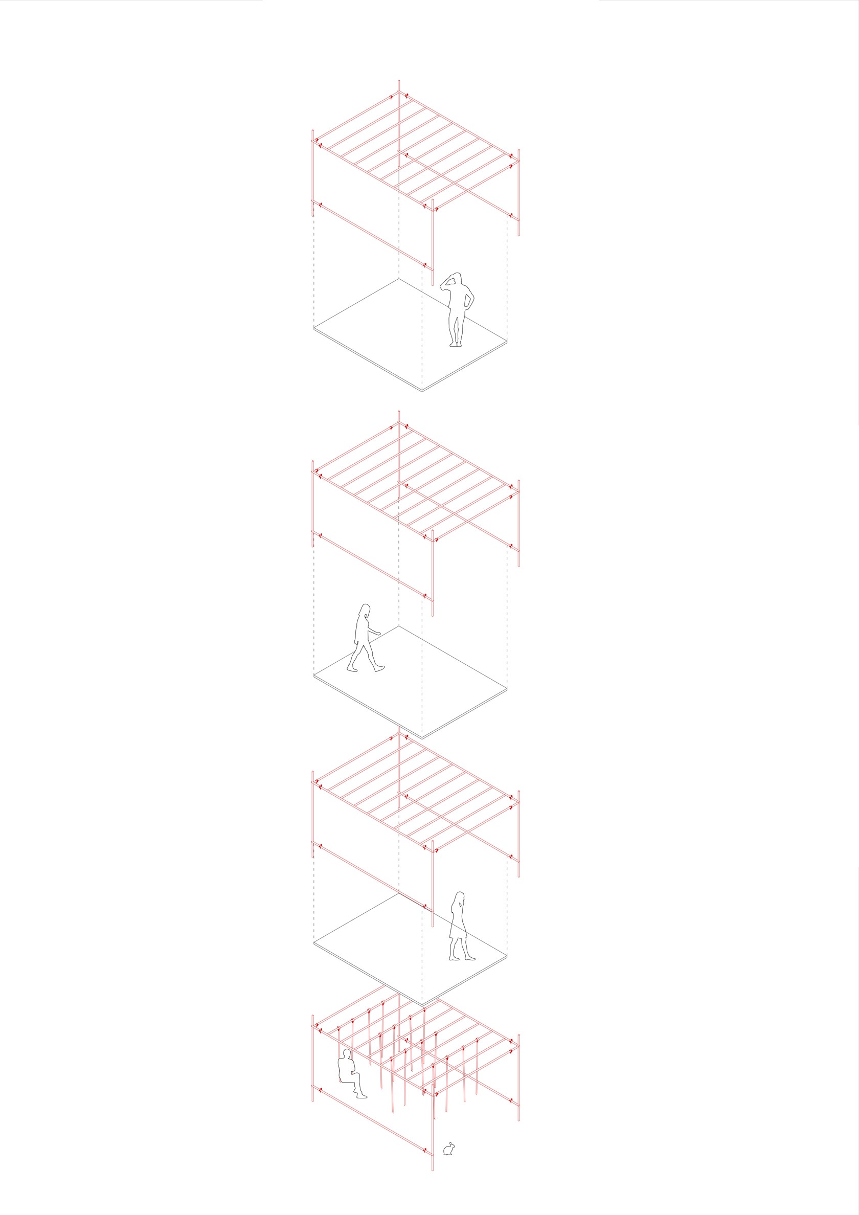
Scaffolding Structure Diagram 1:50
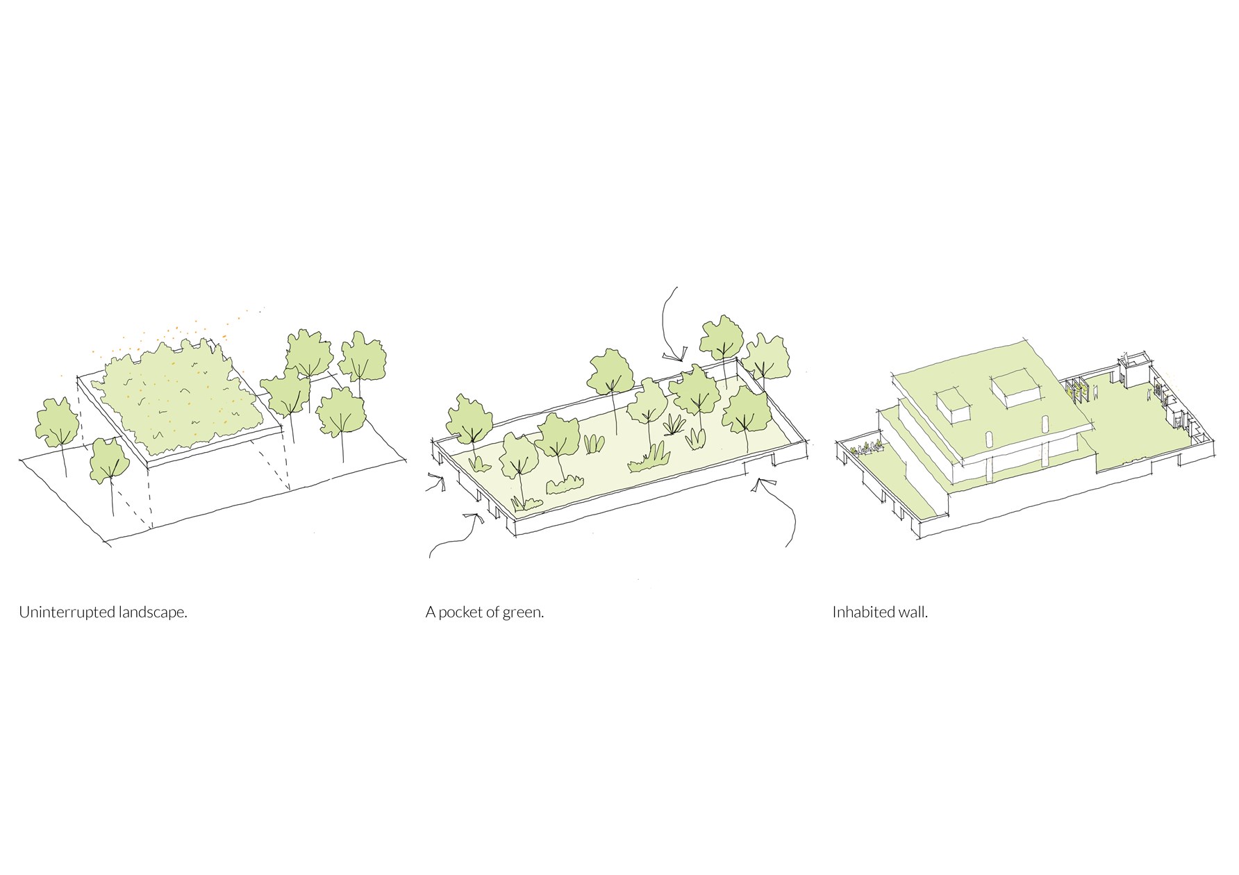
Concept Sketches
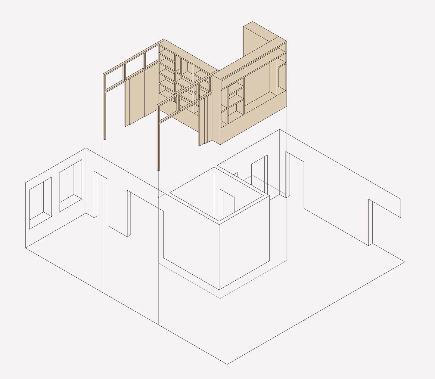
Transforming spaces through timber inserts

The Cross Concept
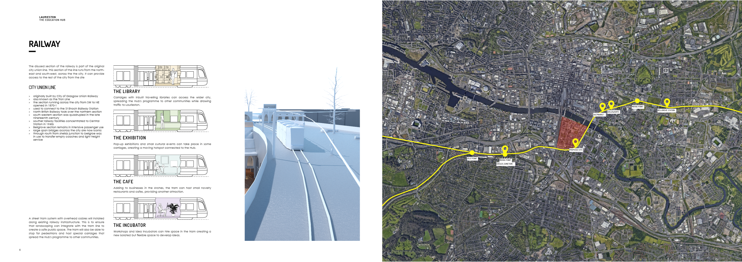
The Railway Line
Conceptual Diagrams
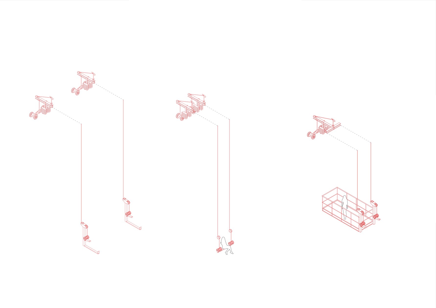
Exploded Axonometric Detail 1:50
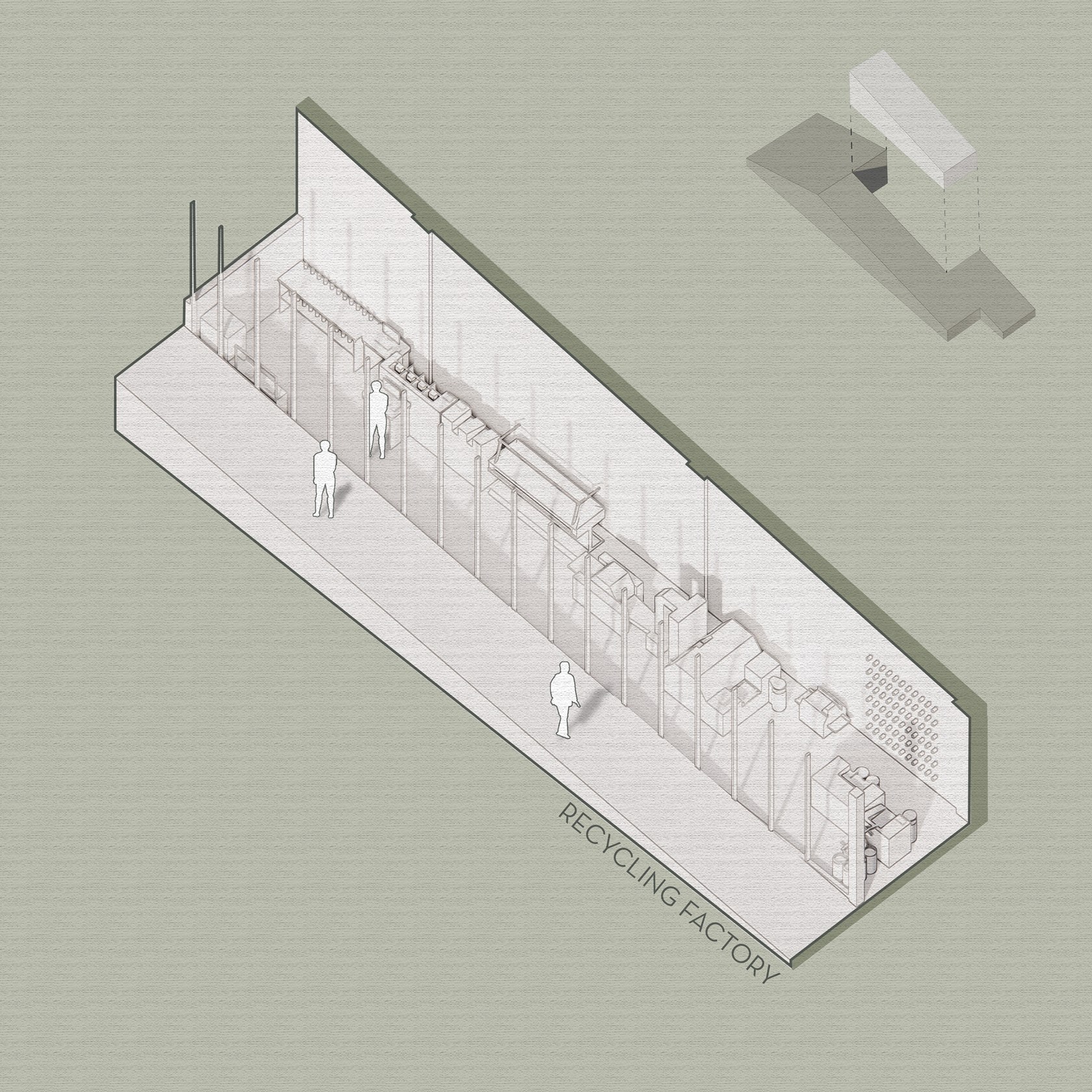
Recycling Factory
Scaffolding Structure Diagram 1:50

Biodiversity Section
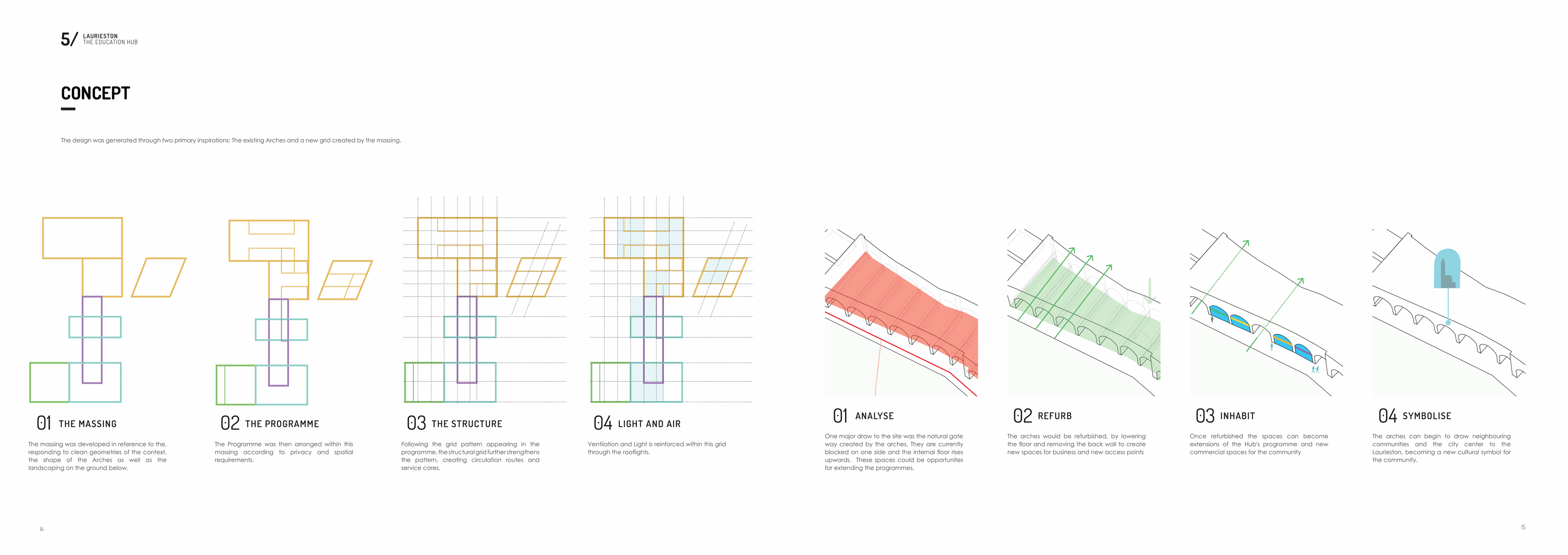
Concept
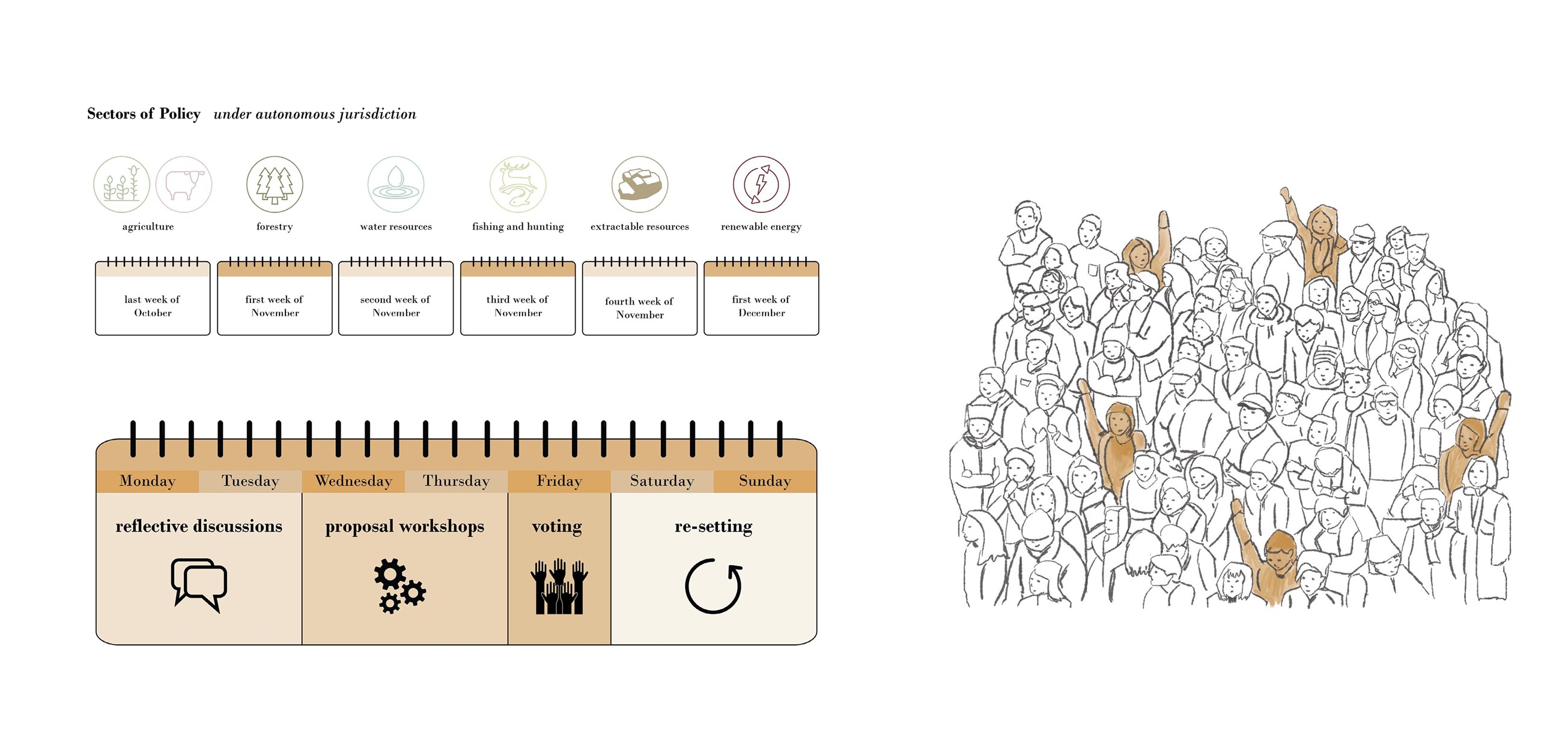
Programme for the Rhodope Council

City Brief Diagram
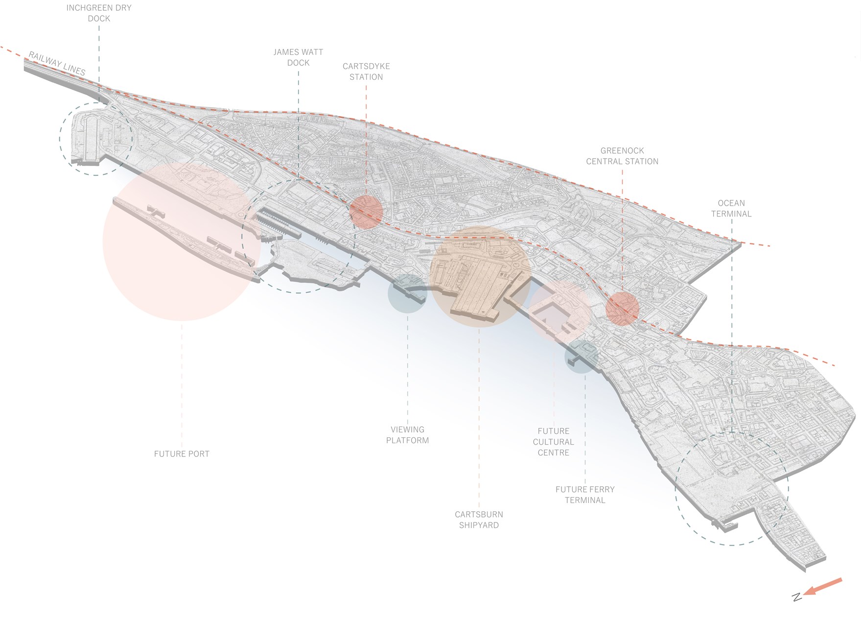
Future Riverfront Masterplan Diagram
Exploded Axonometric Detail 1:50

DFN Proposed Buildings
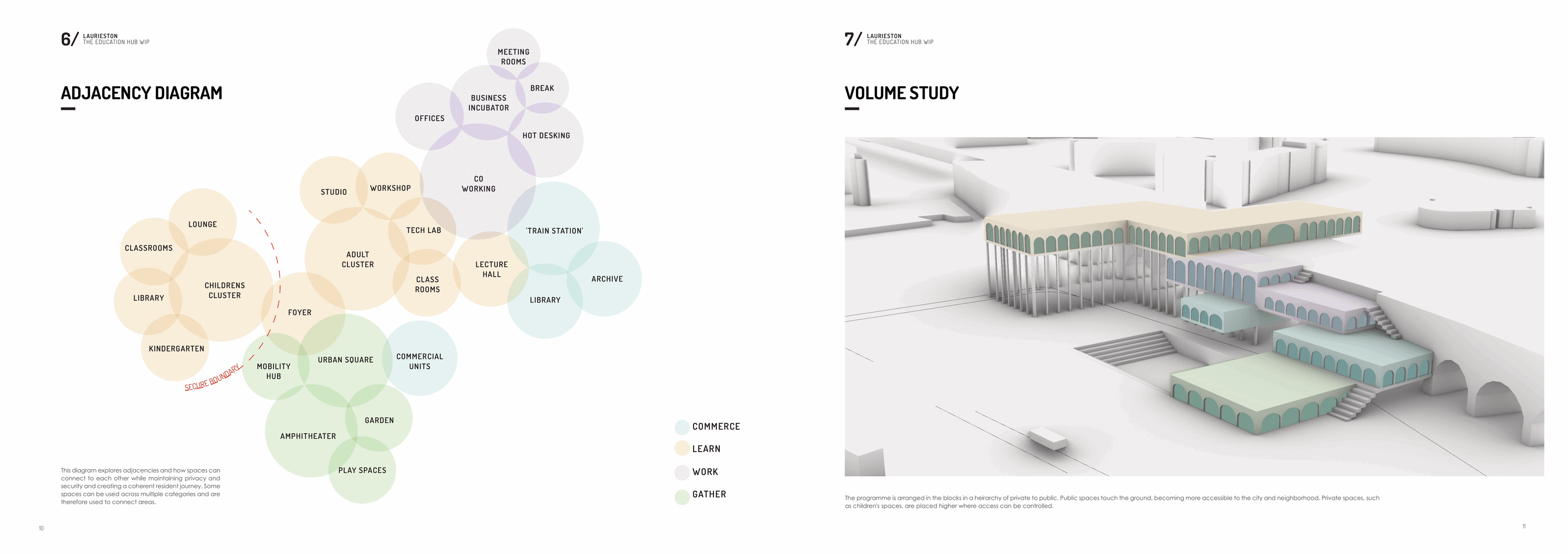
Adjacencies and Volume Study